|
By David Kier
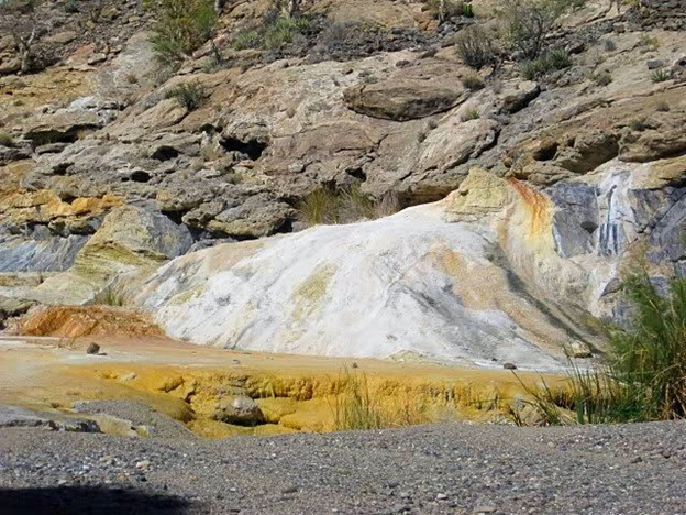
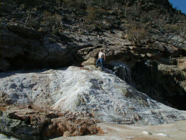
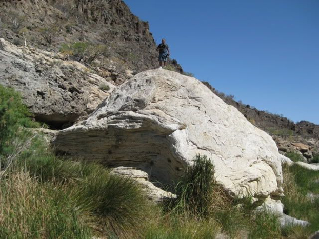
A special geologic place of interest is El Volcán, a bubbling-soda spring of cool water where onyx is being created, ever so slowly. I had first read about El Volcán in the 1962 Lower California Guidebook, by Howard Gulick and Peter Gerhard. My first visit was in 1974, during the first trip driving myself around the peninsula and exploring places of interest. Since then, I returned four more times to Arroyo El Volcán.
Baja California never ceases to amaze us with its interesting attractions, ranging from wildlife to geology to exotic cactus species to its many outdoor activities.
The earliest mention of El Volcán I have read is from 1947, on page 13 of the December issue of Desert Magazine. Here, we can read how this soda spring was reported to erupt monthly into a 60-foot geyser for several minutes. This eruption could even be heard in El Mármol, some miles distant. A ground tremor was also felt in the onyx mining village. No doubt, this is why they named it ‘El Volcán’ (The Volcano). Walt Peterson also shares this story in his magnificent, 1987 The Baja Adventure Book.
In the 1961 book, The Forgotten Peninsula, Joseph Wood Krutch explains how onyx here is formed, and that iron and manganese in the water create colors in the onyx. When Krutch visited El Volcán, a burro train was still the only way there.
By the 1970s, an auto road was completed past Arroyo El Volcán and on to La Olvidada, a barite mine ten miles from El Mármol. This road goes north-east from the 'world-famous' El Mármol schoolhouse, believed to be the only one made from blocks of onyx. Getting to El Mármol from Highway #1 has always been an easy 9.3 dirt-miles from Km. 149, south of San Quintín. Read more
To find El Volcán, set the odometer to zero at the schoolhouse. At Mile 2.0, the road turns east and begins a steep drop to the bottom of Arroyo El Volcán, reached at Mile 4.0. A four-wheel-drive may be needed for the final two, steep miles. Such a vehicle is always the best choice for any dirt-road driving. Conditions can easily change from the latest road reports.
When you arrive at the arroyo crossing, the geyser dome is 0.4 mile to the south, on the right bank of the arroyo. It may be possible to drive part of this short distance. GPS: 29.9925, -114.7709. Just past the active geyser dome is the previous dome now a solid mass of onyx.
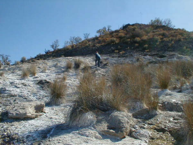
At El Volcán, onyx is formed inch by inch, as the mineralized water emerges from deep below and then evaporates on the earth’s surface. Springs of bubbling chilly water are not only around the geyser dome. A quarter mile past the Arroyo El Volcán crossing, the La Olvidada road passes a hill whose whitened slope has several springs. Also, a hike north in Arroyo El Volcán passes more springs.
If the six additional miles to the La Olvidada mine are passable, you will be rewarded with views down to the Gulf of California and some of the Enchanted Islands, north of Gonzaga Bay. Barite is a very dense, heavy rock that is used in the drilling for petroleum. This mine is worked periodically. A rumor that the road would continue on down the mountain to Highway 5 has yet to come true.

They are very good . There website doesn't show you need a title to bring a vehicle across the...

Super easy to sign up for insurance for both our Truck and Four Wheel Pop-Up camper. We had no...

(Translated by Google) I like the insurance because you can buy it for one day and it insures you...